Monday, July 31, 2006

The happiness of manwon, real names, and dumb laws

A Chosun Ilbo article titled "Singer Bada in Bid to Boost Birthrate" (dig that awesome allitertion) details one of the most brilliant publicity schemes I've ever heard of.
Eight years after her debut, the pop singer Bada is preparing to market her first solo concert, “Showman aLive,” with a novel twist. The concert will be held at Samseong-dong's COEX convention center in Seoul on July 29, and the singer and her management plan to do their bit for the nation’s paltry birthrate by encouraging people to have children under the slogan "the happiness of manwon." Concertgoers who have more than two children will be given a "manwon" or W10,000 note, according to Network Live, the organizer of the concert.
Methinks someone needs some new management. "Happiness of Manwon (만원의 행복) "? Supporting increasing the birthrate? Wouldn't donating a portion of ticket sales to organizations helping flooding victims be a more pressing and timely issue to latch onto? Maybe it isn't; that's likely why I don't manage crappy pop singers. I mean, most people would agree that members of the indie band Couch dropping their pants on live tv a year ago (has it been that long?) was a pretty stupid idea, but it doesn't seem any worse than handing out manwon to concertgoers with more than two children. How many people in her audience would even have three or more children (yes, yes, I realize that's the whole point - they won't be handing out any more than a dozen King Sejongs). In case you were wondering how they determined who was eligible, they (unsurprisingly) simply used the Resident Number of those buying tickets to confirm the number of children a ticket-purchaser had (Korean article here).

On a note related to resident numbers, this article tells us that the government decided last week that Korean internet users will be required to have their identification checked to post comments on web portal sites with more than 300,000 visitors a day and media Web sites with over 200,000 visitors. It was also just over a year ago that the awareness of 'cyber-lynching', brought on by the dog-poop girl affair, led to a great deal of discussion as to what to do about it, the main answer being the use of real names when posting comments. What isn't mentioned in the above article is that there was a great deal of worry about further use of resident card numbers on the internet due to increasing identity theft, and that a new identification system was being considered. Apparently, that may no longer be the case. The new system will make it even harder for resident foreigners in Korea to take part, but I'm sure that's of little concern to anyone involved in these decisions.

Speaking of questionable government decisions (and music performances), Hongdae's Club Culture Association is trying to get a performance law changed, as it is essentially keeping foreign performers out of clubs there.

When clubs put foreign bands on stage, they are required to get a recommendation from the Korea Media Rating Bureau first and then obtain ``performance visas'' from the government.
The [...] Bureau, citing the performance law that categorizes clubs as restaurants as they sell alcohol, have rejected clubs' applications.[...]

[T]he Korea Media Rating Bureau is firm on its position not to allow performance visas to clubs that sell alcohol. ``We can only give our recommendation when performances are held without alcohol in accordance with the performance law,'' an official of the bureau said.[...]

In 2002, former Seoul Mayor Lee Myung-bak pledged to designate the area a cultural district in his election campaign. However, the pledge was not fulfilled. The government has been claiming that designating the area as a cultural district could speed up commercialization and increase real estate prices.

Can't...serve...alcohol...at music...performances? In Korea? The land of the morning hangover? Is this an excuse to keep out foreign performers and the influences their musical subcultures bring (as well as the accompanying international/racial mixing), or does this have more to say about Korean Confucian/Protestant ideas regarding entertainers and youth gathering in cramped, dark, sweaty clubs? The hubbub over the pants-dropping incident last year did show that there was a lot of distrust of this 'indie' music performance culture, so different from the pop concerts shown on tv where teenage girls scream and cry in the presence of Crappyjunior or Ddongfangshitgi; even former mayor Lee Myung-bak called for monitoring these indie clubs in Hongdae at that time. Combine all of these attitudes with bureaucracy and a fear of the dreaded real-estate bubble and who knows if the law will ever be changed; the hub of Asia tilts a little further towards the edge of the map...

Sunday, July 23, 2006

Under the paving stones, the runway

Last week, via the Marmot, I came upon this photo of Yongsan Garrison taken in the 1940s:


The photo was originally posted here, where present-day landmarks are pointed out. You can also download a full-sized photo there. A comment on the Marmot's post reveals that the photo is captioned as follows:
Photo by US Army - 24 September 1948
HQ, 7th US Infantry Division, 31st and 32nd Infantry Regiments
Samgak-Ji, Yongsan, Seoul
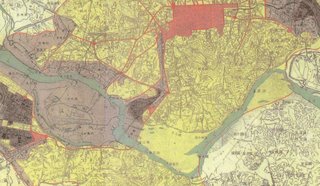
At the time the US occupied Seoul after liberation (when they took over the former Japanese barracks at Yongsan which are pictured above), the U.S. Army Map Service made a map titled "Kyongsong or Seoul (Keijo) Kyonggi-do (Keiki-do), Korea" (original scale 1:12,500) in 1946. It can be found in full here. Pictured below is the part of the map which describes the landscape in the photo above; as the photo is facing east, the foreground of the photo can be seen at the left of this map, and the background is at the map's right:


My attention was drawn back to this photo after the Metropolitician linked to it and came up with a theory as to how the photo was taken:
More likely is this picture perhaps being shot from a plane window [...] I know that Yeouido was a landing strip for US planes for a long time, but not sure if 1) this picture was indeed taken in the late 1940's, and 2) if it was, when the US airstrip in Yeouido appeared. Still, it seems like this shot would make sense if a soldier snapped a shot while on approach for a landing in Yeoiudo. The picture seems like it was taken from around the right altitude, from my experience as a civilian plane traveler. If I were on approach to land in Yeouido, it seems like this would be a very possible snapshot to take.
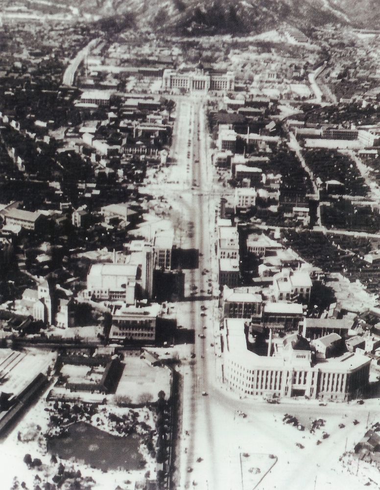
Well, the comments upon the Marmot's post revealed that the picture was indeed taken in 1948. At that time, many aerial photos of Seoul (and elsewhere in Korea) were taken by the US military, such as this one of downtown Seoul:


As for Yeouido Airport, it was not built by the US, but by the Japanese. According to this site, in 1916 a rough surface air strip was built on Yeouido, and it became an official airport in 1924, serving international, domestic, and military flights. It was also the site of a flight school. After 1948 it became a civilian airport. I managed to find this photo of the airport from the 1930s:


Here's a photo of composer An Ik-tae leaving the airport in 1955 (perhaps those are the same buildings in the distance?)


Yeouido Airport was turned over to the military in 1958, when Gimpo became the new international passenger airport (Gimpo had been built between 1939 and 1942 by the Japanese). In the late 1960s the decision was made to develop Yeouido. In 1967 construction began on embankments to protect the island from the flooding that had always made it useless land (Yeouido means "You can have it").

Yeouido, looking north, 1967

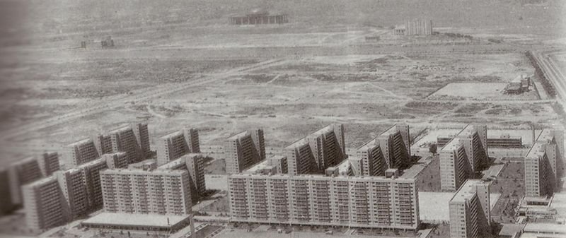
By 1968, the walls were completed, leading to this photo, which looks south-east:


To complete this historical footnote, in 1971, the Sibum apartments, Korea's first high-rise apartment complex, was completed, and the all important 5.16 plaza was built in front of the National assembly (to commemorate Park Chung-hee's May 16, 1961 coup, of course). This square was turned into a park in 1999. As this photo shows, the outer shell of the new national assembly (which wouldn't open until 1975) seemed to be completed at the time of the Sibum apartments' construction.

Looking west from the current location of the 63 building

Now, if we look at the runway visible in the two photos above (which were taken from this Hankyoreh article), we can see that the runway is running across the island from east to west (or vice versa). This 1939 map, which shows the runway, makes it a bit clearer:


Now, the Metropolitician wondered if the photo of the Yongsan barracks was taken from a plane about to land at Yeouido airport. Perhaps if he had read this article about Gimpo airport by Andrei Lankov, he might have been confused (as I was, until I found these photos), because of this description:
At the time, the nascent Korean civil aviation used Yoido airfield, located on the spot now occupied by Yoido Park, (its unusual, elongated shape still betrays its origin as an air strip).
Yeouido park actually runs from north to south, so it can't possibly occupy the spot of the airstrip, which ran from east to west. If you look closely at the map, the red dot in the very middle would be the Samgakji Rotary; the plane would have likely been flying in a north to south direction (or vice versa, but let's assume north to south if it was landing). It would therefore be necessary to turn close to 90 degrees after taking the picture - at a spot that is only 3 or 4 kilometers from Yeouido's runway. The low-flying plane from which the photo was taken would have been quite a bit smaller than those of today, but would it have been normal protocol to make such a turn so close to the runway? I really don't have a clue about such things; perhaps someone can comment on this. I'm quite certain the photo was taken from a plane, and a low flying one at that, but due to the location and direction of the runway, I have my doubts that it was taken while landing.